|
Plenary
Lecture
Airborne Imaging in the Tropical Environment:
Past Experience & Future Prospects

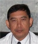
Professor Kamaruzaman Jusoff
Tropical Forest Airborne Observatory (TropAIR)
Faculty of Forestry, Universiti Putra Malaysia
Serdang 43400, Selangor, MALAYSIA
E-mail:
kamaruz@putra.upm.edu.my
Abstract: Imaging spectrometry, also called
hyperspectral imaging, is gaining widespread interest as
a remote sensing technique that allows for quantitative
determination of the abundance and composition of Earth
surface materials at the subpixel resolution level.
Hyperspectral imaging sensors collect radiance data from
airborne and spaceborne platforms that must be converted
to apparent surface reflectance before analysis
techniques can be brought to bear. In this plenary, I
present my past experience using airborne hyperspectral
imaging sensor for a variety of environmental and forest
engineering related applications. I begin by providing a
brief overview of airborne hyperspectral sensing and
show its operational set up for data acquisition over
the Malaysian airspace as a showcase of a tropical
environment. I next present a series of examples using
the AISA sensor system for a variety of environmental
research and commercial applications. These include
precision forestry and agriculture using individual
timber tree and oil palm, respectively, rice paddies
land use mapping, coastal zone management and derivation
of useful parameters of interests for montane
dipterocarp hill forest environmental conservation and
management. In addition, I outline my efforts to propose
a carbon flux and dynamics model with lidar-derived
tropical forest structure for improved carbon stocks and
flux estimation. I then explore the use of airborne
hyperspectral sensor observations for other
environmental related applications. Lastly, I provide a
preview of the next generation airborne hyperspectral
systems which hopes to provide spatially continuous
estimates of detail forest composition and structure for
future and better environmental planning and sustainable
development. The truth seems to be out there for the use
of airborne hyperspectral remote sensing for operational
environmental applications and forestry.
Brief Biography of the Speaker:
He is a Senior Professor (Grade VK6/B) in the Department
of Forest Production at Universiti Putra Malaysia (UPM),
and was a Visiting Professor with Yale and Kyoto
University. His research expertise is in Forest
Engineering Surveying. His research interests include
hyperspectral image processing, the estimation of
tropical forest aboveground biomass using airborne
hyperspectral sensing, and improving model carbon
projections of the land surface using other remote
sensing data. He was the Coordinator of Tropical Forest
Airborne Observatory (TropAIR) and the principal
investigator for three Search-and-Rescue (SAR)
operations for the missing military and civilian
aircrafts in Malaysia.
|
