|
||||||||||||||
|
LOCATION:
CONFERENCE LOCATION. Our destination at a Glance
http://en.wikipedia.org/wiki/Mont_Saint-Michel
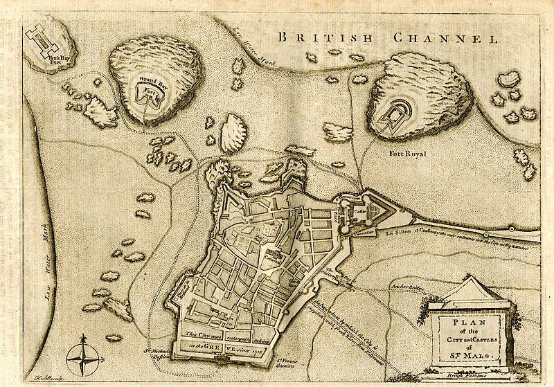
MONT SAINT MICHEL: Mont Saint-Michel (English: Saint Michael's Mount) is a rocky tidal island and a commune in Normandy, France. It is located approximately one kilometre (just over half a mile) off the country's north coast, at the mouth of the Couesnon River near Avranches. The population of the island is 41, as of 2006. The island has been a strategic point holding fortifications since ancient times, and since the 8th century AD it became the seat of the Saint-Michel monastery, from which it draws the name.Mont Saint-Michel was previously connected to the mainland via a thin natural land bridge, which before modernization was covered at high tide and revealed at low tide. This connection has been compromised by several developments. Over the centuries, the coastal flats have been polderised to create pasture. Thus the distance between the shore and the south coast of Mont-Saint-Michel has decreased. The Couesnon River has been canalised, reducing the flow of water and thereby encouraging a silting-up of the bay. In 1879, the land bridge was fortified into a true causeway. This prevented the tide from scouring the silt around the mount. On 16 June 2006, the French prime minister and regional authorities announced a �164 million projec to build a hydraulic dam using the waters of the river Couesnon and of tides to help remove the accumulated silt deposited by the rising tides, and to make Mont-Saint-Michel an island again. It was projected to be completed by 2012. The construction of the dam began in 2009 and is now complete. The project also included the destruction of the causeway that had been built on top of the small land bridge and enlarged to join the island to the continent, and was used also as a parking lot for visitors. It will be replaced by an elevated light bridge, under which the waters will flow more freely, and that will improve the efficiency of the now operational dam, and the construction of another parking lot on the mainland. Visitors will use small shuttles to cross the future bridge which will still be open to pedestrians and unmotorized cycles. Mont-Saint-Michel was used in the 6th and 7th centuries as an Armorican stronghold of Romano-Breton culture and power, until it was ransacked by the Franks, thus ending the trans-channel culture that had stood since the departure of the Romans in AD 460. Before the construction of the first monastic establishment in the 8th century, the island was called "monte tombe". According to legend, the Archangel Michael appeared to St. Aubert, bishop of Avranches, in 708 and instructed him to build a church on the rocky islet. Aubert repeatedly ignored the angel's instruction, until Michael burned a hole in the bishop's skull with his finger. The mount gained strategic significance in 933 when William "Long Sword", William I, Duke of Normandy, annexed the Cotentin Peninsula, definitively placing the mount in Normandy. It is depicted in the Bayeux Tapestry which commemorates the 1066 Norman conquest of England. Harold, Earl of Wessex is pictured on the tapestry rescuing two Norman knights from the quicksand in the tidal flats during a battle with Conan II, Duke of Brittany. Norman Ducal patronage financed the spectacular Norman architecture of the abbey in subsequent centuries. Mont-Saint-Michel and its Bay. In 1067, the monastery of Mont-Saint-Michel gave its support to duke William of Normandy in his claim to the throne of England. It was rewarded with properties and grounds on the English side of the Channel, including a small island located to the west of Cornwall, which was modeled after the Mount, and became a Norman priory named St Michael's Mount of Penzance.During the Hundred Years' War, the English made repeated assaults on the island, but were unable to seize it due to the abbey's improved fortifications. Les Michelettes � two wrought-iron bombards left by the English in their failed 1423�24 siege of Mont-Saint-Michel � are still displayed near the outer defense wall. When Louis XI of France founded the Order of Saint Michael in 1469, he intended that the abbey church of Mont Saint-Michel be the chapel for the Order, but because of its great distance from Paris, his intention could never be realized. The wealth and influence of the abbey extended to many daughter foundations, including St Michael's Mount in Cornwall. However, its popularity and prestige as a centre of pilgrimage waned with the Reformation, and by the time of the French Revolution there were scarcely any monks in residence. The abbey was closed and converted into a prison, initially to hold clerical opponents of the republican régime. High-profile political prisoners followed, but by 1836, influential figures � including Victor Hugo � had launched a campaign to restore what was seen as a national architectural treasure. The prison was finally closed in 1863, and the mount was declared a historic monument in 1874. The Mont-Saint-Michel and its bay were added to the UNESCO list of World Heritage Sites in 1979, and it was listed with criteria such as cultural, historical, and architectural significance, as well as human-created and natural beauty. SAINT MALO: Saint-Malo (Breton: Sant-Maloù; Gallo: Saent-Malô) is a walled port city in Brittany in northwestern France on the English Channel. It is a sub-prefecture of the Ille-et-Vilaine department. Saint-Malo during the Middle Ages was a fortified island at the mouth of the Rance River, controlling not only the estuary but the open sea beyond. The promontory fort of Aleth, south of the modern centre in what is now the Saint-Servan district, commanded approaches to the Rance even before the Romans, but modern Saint-Malo traces its origins to a monastic settlement founded by Saint Aaron and Saint Brendan early in the 6th century. Its name is derived from a man said to have been a follower of Brendan, Saint Malo.Saint-Malo had a tradition of asserting its autonomy in dealings with the French authorities and even with the local Breton authorities. From 1490�1493, Saint-Malo declared itself to be an independent republic, taking the motto "not French, not Breton, but Malouins".Saint-Malo became notorious as the home of the corsairs, French privateers and sometimes pirates. In the 19th century this "piratical" notoriety was portrayed in Jean Richepin's play Le flibustier and in César Cui's eponymous opera. The corsairs of Saint-Malo not only forced English ships passing up the Channel to pay tribute, but also brought wealth from further afield. Jacques Cartier, who sailed the Saint Lawrence River and visited the sites of Quebec City and Montreal � and is thus credited as the discoverer of Canada, lived in and sailed from Saint-Malo, as did the first colonists to settle the Falklands � hence the islands' French name Îles Malouines, which gave rise to the Spanish name Islas Malvinas. In 1758 the Raid on St Malo saw a British expedition land intending to capture the town. However the British made no attempt on St Malo, and instead occupied the nearby town of St Servan where they destroyed 30 privateers before departing. The commune of Saint-Servan was merged, together with Paramé, and became the commune of Saint-Malo in 1967. Saint Malo was the site of an Anglo-French summit in 1998 which led to a significant agreement regarding European defence policy.
Sites of interest
Exact Conference Place:
Grande Plage du Sillon - 35400 Saint-Malo - Tel. 02 99 40 75 75 - Fax 02 99 40 76 00. DO NOT BOOK YOUR ROOM VIA http://www.thalassotherapy.com/, the conference has special rates if you make registration in the conference
1 -From Paris by train
To
reach Saint Malo from Paris by train,
there are two possibilities:
The trains Paris - Saint Malo or
Paris - Rennes leave at railway
station �Gare Montparnasse�. Be
careful, there are several railway
stations in Paris!
Here are the details to go from CDG
airport to Gare Montparnasse:
- Once in the RER suburban railway
station near the airport. Buy a
ticket for Paris. This ticket allows
you to go to whichever station in
Paris, provided you do not go out
the subway network until you reach
your final destination. So, keep it
in your pocket since you will need
it along your journey.
- Take the RER B suburban train to
go to Paris.
- Stop at station
�Denfert-Rochereau� (~ 50 minutes).
- Take the �metro� (subway) line 6 (the
light green one) towards �Charles de
Gaulle Etoile�. Use your ticket to
pass the automatic doors (You do NOT
have to buy another ticket).
- Stop at station �Montparnasse
Bienvenüe� (5 minutes).
- Walk following the signs �TGV
Grandes lignes� (at the end of the
platform, after some stairs, take
right). After the automatic doors,
walk 10 meters and get upstairs with
the escalators. Go upstairs again
with the escalators. Take right.
- Look at the central departures
panel to learn your platform�s
number. Find the platforms just
behind the central departures panel.
Validate your train ticket with one
of the red-orange machines before
taking the TGV (You may get fined if
you do not, even if you have a
ticket).
3
- From Dinard airport
The nearest airport is the Dinard - Pleurtuit - Saint Malo airport. However, it is a very very small airport. There are some cheap flights from/to London Stansted. See the Ryanair website.
I do not know the London Stansted
airport, and especially whether it is
easy to get there (Gwenaël says it is ok).
However, be careful with such low-cost
companies. If you miss the flight, then
you are in trouble because the next one
is the day after.
This might be a good plan for English
people, or attendees flying to London?
The good point is that Dinard -
Pleurtuit - Saint Malo airport is 10km
away from the convention center. Take a
taxi.
4 - Ferries
It
is quite unlikely that one attendee
comes to Saint Malo with a ferry,
although it might be the most pleasant
way.
There are ferry connections with
Weymouth, Poole and Portsmouth. See Condoferries or Brittany
Ferries.
|
||||||||||||||
|
|
|
|
||||||||||||
| copyright - designed by WSEAS | ||||||||||||||